World Rivers 3D Globe
3D globe visualizing the main rivers of the world with interactive information from Wikipedia and Wikidata.
Data: Natural Earth (10 m rivers), NASA Visible Earth basemap, and Wikidata API.
Technologies: Globe.gl (Three.js), Wikidata API, and Wikipedia REST API.
View project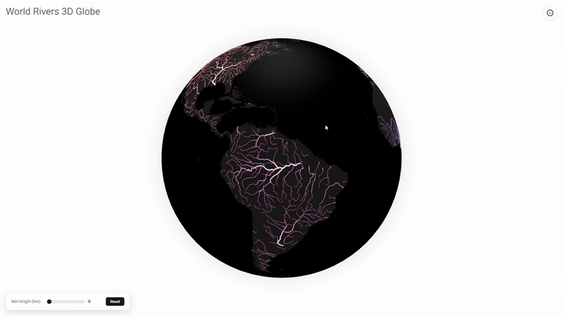
3D Population Map of Spain
3D visualization of Spain's population distribution for 2025, highlighting density patterns across the territory.
Data: WorldPop (1 km grid).
Technologies: Kepler.gl and FME.
View project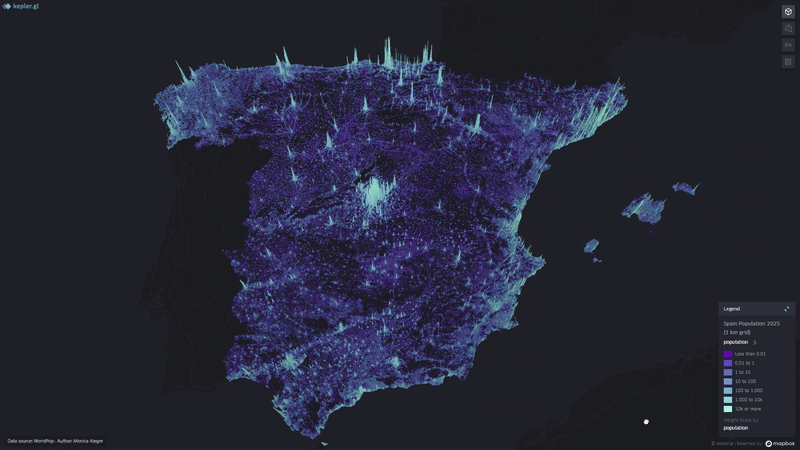
Mountain 3D Viewer
Interactive 3D visualization to explore and compare mountain scale and form. Includes conceptual, contour, and realistic views with adjustable vertical exaggeration.
Data: Copernicus DEM 30 m and Sentinel-2 Cloudless mosaics.
Technologies: Three.js, WebGL, GDAL, and QGIS.
View project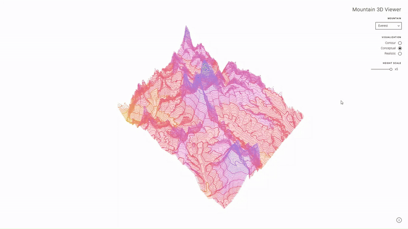
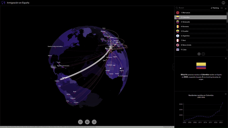
Spain Immigration Globe
3D interactive globe showing immigration flows to Spain, combining data, graphics, and rankings by country.
Data: Eurostat (Population by country of birth), UN WPP, and ArcGIS Living Atlas geometries.
Technologies: ArcGIS Experience Builder, Scene Viewer, and ArcGIS Pro.
View project